Filling the Gaps: Autonomous Oxygen Monitoring in Cape Cod Bay
Across multi-day missions in late August and September, a solar-electric robot ran over 30 water-column casts across Cape Cod Bay, lowering a sensor from the surface to the seafloor and back, then moving on to the next station.
9/15/20265 min read


Across three multi-day missions in late August and early September, a solar-electric robot ran 30 water-column casts across Cape Cod Bay, lowering a sensor from the surface to the seafloor and back, then moving on to the next station.
It worked overnight. It worked through wind and rain. It held position by itself when it was not sampling.
And by the second mission, the readings were flowing automatically into the Massachusetts Division of Marine Fisheries public dissolved oxygen dashboard, where the lobster fleet already looks, in real time.
Nobody went out to collect the data. It was already there.
WHY DISSOLVED OXYGEN, AND WHY CAPE COD BAY
In 2019, a mass of low-oxygen water settled over part of Cape Cod Bay. Animals that could swim away did. Lobsters sitting in traps could not, and fishermen hauled up losses.
Water holds less oxygen as it warms. When the bay stratifies in summer, the bottom layer is cut off from the surface, and oxygen down there gets consumed without being replaced. The result is a patch of water that is uninhabitable for the animals living in it, and it can form, drift and dissipate over a matter of days.
The response to the 2019 event was both innovative and collaborative. The Lobster Foundation of Massachusetts, working with the Division of Marine Fisheries (DMF), created the Cape Cod Bay Study Fleet. Working lobster boats carry oxygen loggers on their traps. These loggers automatically upload their data when traps are hauled, and the captain sees the real-time data on a deck box. This data feeds a public map that anyone can check before deciding whether to set gear.
It works. Fishermen contribute data and have a tool to stay informed. The catch survives to market.
But the study fleet is relatively small, and being focused on the catch, they sample where and when they fish. This means the data is dense where the gear is and thin everywhere else, and it goes quiet when the traps are in the water and boats are at the dock, or out of season.
A patch of low-oxygen water does not restrict itself to fished ground. It can form somewhere nobody is fishing and drift into somewhere everybody is.


A gap in spatial and temporal coverage like that is exactly the sort of problem you solve with a machine that does not need to be paid, fed, or brought home at night.
WHAT WE DID
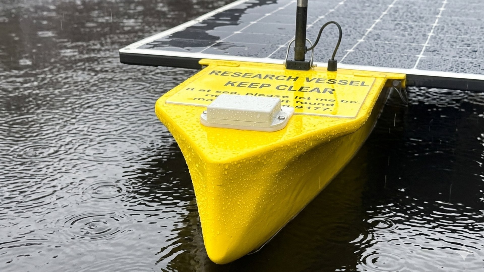
Warden is a solar-electric autonomous surface vessel about seven feet long, roughly kayak-sized, launched from a beach by one person.
For this work it carries a small winch and a moonpool, an opening through the hull. At each station it stops, lowers a logging sensor down through the water column to the seafloor, lets it rest for several minutes, brings it back up, and moves on. Each cast takes under ten minutes.
Our choice of logger is actually very important. Warden uses the same rugged device the Study Fleet already uses on their traps, manufactured by Lowell Instruments in East Falmouth, MA. We deliberately did not invent our own sensor. Our goal is to complement the existing cooperative research program rather than compete with it. By using the same logger and open source code onboard Warden that would typically run on the deck box of a lobster boat, the data is directly comparable, and the public data pipeline is already in place. A Warden just becomes registered as a new member of the fleet!
One full year of Study Fleet coverage showing persistent gap in spatial coverage that prompted the first Warden mission


Nick Lowell of Lowell Instruments and Andrew Gregg of Sedna Robotics pose with a Warden and a pair of logging sensors
The first mission, in late August, ran ten casts along a track across the southeastern quarter of the bay, capturing a large area where there was no data. Warden worked all day and station-kept at night. Depths at the sampling stations ranged from about 12 ft to over 100 ft.
The second mission, in early September, ran eight casts in a second area that was identified by DMF as an area of interest not covered by the Fleet this year. Our planning tool converted a napkin sketch circle into a grid of samples. We launched at seven in the morning from Sandy Neck Beach in Barnstable. Warden worked the grid through a twelve-hour autonomous route, then settled into station-keeping overnight and came home through a rainy bay the next morning.


Low Dissolved Oxygen advisory prompting second round of sampling
Four days, 18 samples covering 100 square miles, with one person on the beach at each end. After the first two missions, it became routine. The following week we sent a Warden out for three days to perform an additional 12 casts in the same region!
WHAT WE MEASURED
Across the 30 casts, dissolved oxygen readings ranged from roughly five to just over nine milligrams per litre, with the lower values generally at depth at the deeper offshore stations and the higher values nearer the surface and in shallower water.
DMF is closely monitoring this data, using it to generate alerts for lobstermen, as well as improving our historical baseline understanding.
THE GREAT PART
Partway through this work, the data pipeline came together.
Warden now filters each cast onboard, checking readings against known water depth and winch behaviour so that only genuine bottom measurements are kept, then uploads immediately. Working with the team at Lowell Instruments, those filtered readings now land in the DMF public dissolved oxygen dashboard during its daily updates.
This is the difference between a demonstration and a contribution. A robot that collects excellent data into a hard drive that somebody downloads three weeks later has not helped anyone decide whether to set gear. A robot whose readings appear on the same public map the fleet already checks, within hours of the sensor coming off the bottom…that robot begins to earn its way onto the fleet.


Screenshot of public dissolved oxygen data viewer with Warden regular grid samples amongst the Study Fleet measurements
We are proud to contribute actionable data to lobstermen AND long term data to the public record. Thanks to the amazing team at DMF and Lowell Instruments who made this happen quickly!
WHAT COMES NEXT
The long term aim is straightforward. Fishermen should not have to choose between fishing and collecting data. The Study Fleet model already proves that fishermen are eager to collect data if the equipment simply works while they work. Warden's job is to cover the water they are not on, at the hours they are not there, and to put the results in the same place for them.
We fill in the gaps for fishermen while they fish.
Sedna Robotics builds Warden, a solar-electric autonomous surface vessel for ocean and aquaculture monitoring, in New Bedford, Massachusetts. If you fish these waters and there is a patch of water you wish somebody was watching, we want to hear about it.